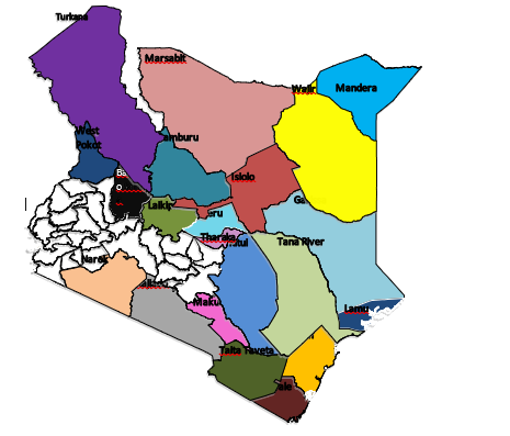
Project Area
In Kenya, the project targets 21 Arid and Semi-Arid Lands (ASAL) counties of Turkana, Marsabit, Isiolo, Laikipia Mandera, Wajir, Garissa, Tana River, Taita Taveta, Kilifi, Kwale, Lamu, Meru (Meru North sub county), Tharaka Nithi, Samburu, Baringo, West Pokot, Narok, Kajiado, Makueni and Kitui where pastoralism type of farming is done and drought insurance products for livestock (Index-Based Livestock Insurance products) are viable. However, in Component 2, project investments will also be considered in other Counties if they are private led, demonstrate commercial viability and show linkage to pastoralism in the project counties.